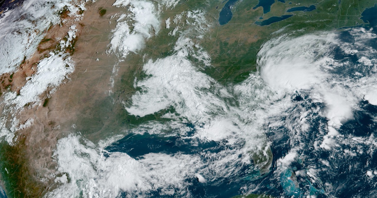
An area of heavy rain and thunderstorms off the coast of North Carolina and South Carolina Monday morning, designated Potential Tropical Cyclone 8 (or PTC 8 for short), is the next potential Atlantic system that could affect the continental United States.
As of 11:00 a.m. Eastern Time Monday, the core of the system, located 75 miles east of Charleston, South Carolina, was producing tropical storm-force wind gusts and torrential rain, particularly from Wilmington to Carolina Beach, North Carolina.
The storm occurred a week after Hurricane Francine made landfall in Louisiana, leaving hundreds of thousands of people without power for days.
According to the National Weather Service in Wilmington, several locations have already recorded double-digit rainfall amounts from the latest system, including more than 15 inches in Carolina Beach.
In addition to the rain reports, some impressive wind reports were also recorded from buoys in the Atlantic just off the Mid-Atlantic coast. These included a NOAA buoy at Frying Pan Shoals, North Carolina, which reported a sustained wind of 47 mph with a gust of 56 mph, and another NOAA buoy off the coast of Wrightsville Beach, North Carolina, which reported a sustained wind of 38 mph and a gust of 54 mph.
Meanwhile, Wilmington, North Carolina, recorded a wind gust of 60 mph on Monday morning.
As the system slowly moves toward the coast, it is running out of time over open water to form sufficiently into a tropical or subtropical system. Even if it does not become a named system, the area of unsettled weather will move inland between Charleston and Myrtle Beach on Monday afternoon.
Named or not, this does not change the impacts of wind and rain that are expected with the system.
Tropical storm conditions are expected along the Carolina coast throughout Monday. Heavy rain, gusty winds, and isolated tornadoes are possible.
Rain will continue across the Mid-Atlantic coast on Tuesday and Wednesday, affecting parts of Virginia, Maryland, Delaware, New Jersey and New York.
A minor storm surge of 1 to 3 feet is expected from the South Santee River, South Carolina, to Oregon Inlet, North Carolina, and along the Neuse, Bay, Pamlico, and Pungo rivers in North Carolina.
From northeastern South Carolina to central North Carolina, six million people are affected by a flood warning. The flood warning includes Myrtle Beach, Wilmington, Cape Hatteras and Raleigh.
As for the outstanding rainfall forecasts, 4 to 8 inches could fall from South Carolina to southeastern North Carolina, with local amounts up to 10 inches.
Inland North Carolina, 5 to 10 centimeters of rainfall could fall by Tuesday, with locally higher amounts of up to 15 centimeters.
And across Virginia, 1 to 3 inches of rain are possible through Wednesday.
Elsewhere in the Atlantic basin, Tropical Depression Gordon continues to move over the open ocean and is forecast to restrengthen into a tropical storm by the end of the week as it meanders across the Atlantic without posing a threat to land.
Beyond today’s Mid-Atlantic system and Gordon in the tropical Atlantic, attention will then turn to the western Caribbean this weekend, where global forecast models indicate possible development in this region until the last week of September.

